


When you think about installing solar panels or heat pumps, you probably picture a professional visiting your home, taking measurements, and evaluating where equipment might go. But today, clean energy professionals can gather valuable information about a property before ever stepping foot on-site.
One technology that makes this possible is LiDAR.
But what is LiDAR, and how can it support the planning process for solar panels and heat pumps?
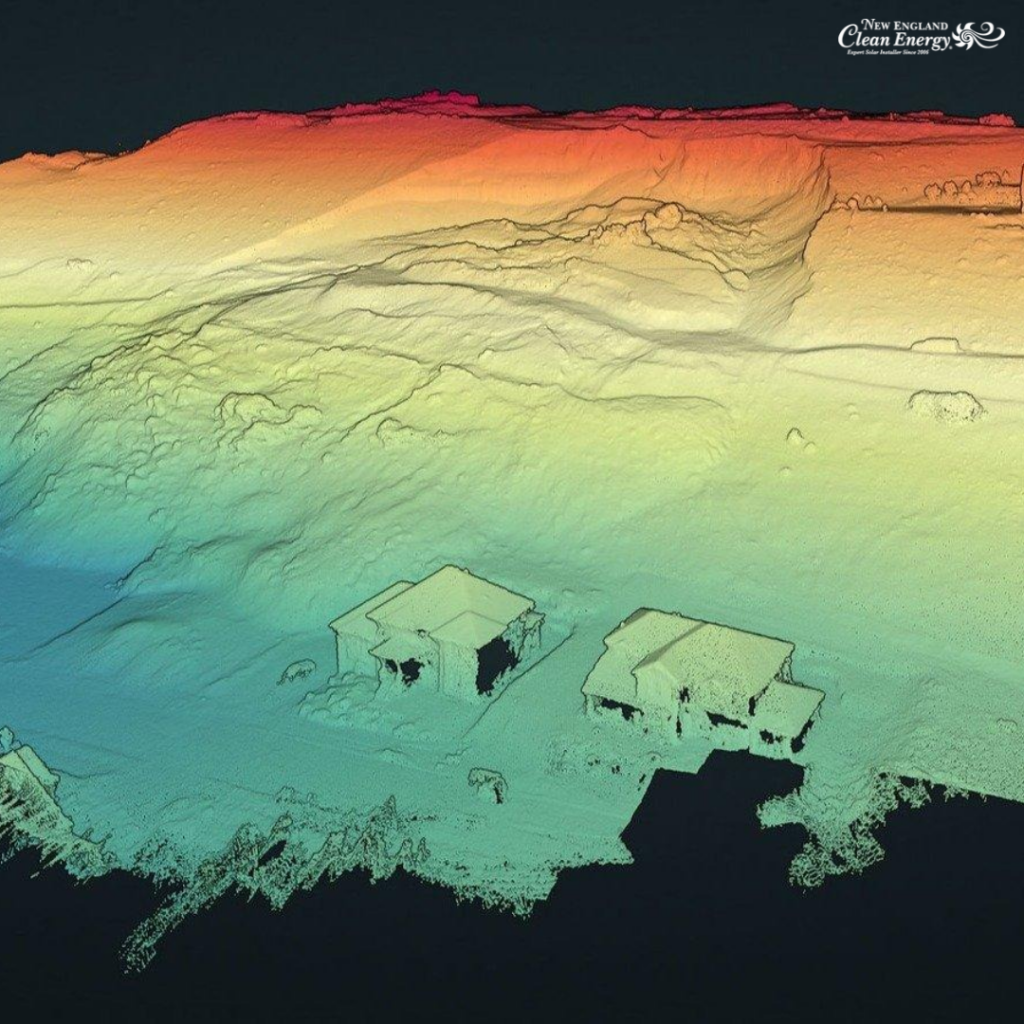
LiDAR technology uses laser measurements to create detailed three-dimensional representations of buildings, trees, and surrounding landscapes. In solar planning, this information can help evaluate roof characteristics, identify potential shading, and support preliminary system designs. For heat pump planning, building and site geometry may provide useful context when reviewing a home and its surroundings, although additional assessments are necessary to design and size a heating and cooling system.
For homeowners throughout New England, where mature trees, complex rooflines, and changing seasons influence clean energy projects, this type of property information can be especially useful.


What Is LiDAR and How Does It Work?
LiDAR stands for Light Detection and Ranging. It’s a remote sensing technology that uses laser pulses to measure distances between a sensor and surrounding objects.
Here’s how it works.
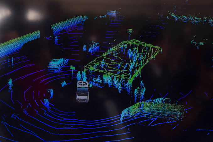
A LiDAR sensor sends out thousands or even millions of laser pulses toward the surrounding environment. When those pulses strike an object, such as a rooftop, tree, or building, some of the light reflects back toward the sensor.
By measuring how long the light takes to return, the system calculates the distance to each object.
These measurements are then combined to create a detailed three-dimensional model of the area.
Unlike a standard photograph or satellite image, which primarily shows what a property looks like from above, LiDAR data can provide information about the height, shape, and position of physical features.
According to the U.S. Geological Survey (USGS), LiDAR measurements can be used to generate detailed 3D datasets representing buildings, vegetation, and terrain.
For clean energy professionals, that additional detail can be valuable when evaluating a property and preparing for the next steps in a solar or heat pump project.
How Is LiDAR Used in Solar Planning?
Before designing a solar energy system, installers need to understand the physical characteristics of a property.
This includes evaluating the roof’s dimensions, orientation, slope, surrounding trees, and nearby structures that could affect sunlight exposure.
Traditionally, gathering this information required extensive measurements and observations at the property. Today, solar designers can use satellite imagery, mapping software, and available LiDAR data to develop a more informed preliminary assessment.
LiDAR can help solar professionals:
- Evaluate roof dimensions: Estimate the size and shape of different roof sections.
- Identify roof slopes: Understand how roof angles may affect solar panel placement.
- Analyze surrounding trees: Determine the approximate height and location of vegetation that could create shade.
- Assess nearby structures: Identify buildings or other obstacles that may block sunlight.
- Support system layouts: Help determine which roof areas may be suitable for solar panels.
The National Renewable Energy Laboratory (NREL) has used LiDAR data alongside geographic information systems to assess rooftop suitability for solar installations, considering factors such as roof orientation, available space, and shading.
While LiDAR doesn’t make every design decision automatically, it provides information that can make the early planning process more informed.
Can LiDAR Help With Heat Pump Planning?
LiDAR is most directly useful for solar planning, but three-dimensional property data can also provide helpful background information for some heat pump projects.
Heat pumps provide heating and cooling by moving heat rather than generating it through combustion. Before installing a system, professionals need to understand the home’s heating and cooling needs, the available space for equipment, and the practical requirements of installation.
Depending on the detail and quality of the data, LiDAR-based models may help with early-stage questions such as:
- Understanding exterior building geometry: Reviewing the overall shape, height, and layout of a building as part of a broader property assessment.
- Reviewing surrounding conditions: Identifying nearby buildings, vegetation, slopes, and other site features that may be relevant when planning where to inspect potential outdoor equipment locations.
- Preparing for an on-site visit: Highlighting areas where the installation team may need to take additional measurements or check access.
- Coordinating solar and heat pump projects: Providing a common picture of the property when homeowners are exploring multiple clean energy upgrades.
These are supporting uses, not substitutes for heat pump design. LiDAR does not reveal a home’s insulation levels, air leakage, ductwork condition, room-by-room comfort needs, or electrical capacity. It also cannot confirm that a proposed outdoor unit location meets the manufacturer’s clearance, drainage, snow, and service-access requirements.
A properly designed heat pump system requires heating and cooling load calculations and appropriate equipment selection. The U.S. Department of Energy’s Building America guidance on ductless mini-split heat pumps explains the importance of load calculations, system sizing, and choosing indoor and outdoor equipment locations.
In other words, LiDAR may help inform preliminary planning, but it does not determine what size heat pump a home needs.
How LiDAR Helps Evaluate Roofs and Shading
One of the most important considerations when installing solar panels is sunlight exposure.
Solar panels generate electricity from sunlight, so the amount of shade a roof receives can affect how much energy a system produces.
A roof might look ideal from the ground, but nearby trees, chimneys, dormers, or neighboring buildings can create shadows throughout the day.
This is where LiDAR can be particularly helpful.
Because LiDAR data captures the height and location of objects, solar modeling software can use that information to estimate where shadows may fall as the sun moves across the sky.
For example, a tall tree on the southern side of a property might block sunlight during certain hours, particularly when the sun sits lower in the sky during winter.
A LiDAR-based model can help identify that potential issue before a final solar design is developed.
In fact, NREL’s research into rooftop solar potential evaluates roof suitability using shading, tilt, orientation, and available roof area. In the underlying analysis, suitable roof sections needed to meet specific criteria, including producing at least 70% of the energy of an equivalent unshaded system.
The information can also help designers compare different roof sections and determine where solar panels may receive the most useful sunlight.
However, shading models still depend on the quality and age of the available data. Trees grow, branches are removed, and property conditions change, so current conditions may need to be verified.
Why Property Mapping Matters for Clean Energy Projects in New England
New England presents some unique challenges when it comes to planning solar and heat pump projects.
Homes throughout Massachusetts, Rhode Island, New Hampshire, and Maine often feature mature trees, varied roof designs, and surrounding landscapes that can influence solar potential and shape practical installation considerations.
A property might have a large roof, but that doesn’t necessarily mean every section is suitable for solar panels.
Several factors can affect clean energy project planning.
Mature Trees and Wooded Properties
New England is known for its heavily wooded neighborhoods. While trees provide shade and privacy, they can also reduce the sunlight reaching a rooftop.
LiDAR data can help identify the location and height of surrounding trees, allowing solar designers to better understand potential shading conditions.
Complex Rooflines
Many New England homes have multiple roof sections, dormers, chimneys, and varying roof slopes.
Three-dimensional roof information can help designers evaluate available space and identify areas that may be more practical for solar panel placement.
Seasonal Sunlight Changes
The sun’s position changes throughout the year, which means a roof that receives excellent sunlight during the summer may experience more shading during the winter.
When combined with solar modeling software, LiDAR data can help evaluate how surrounding obstacles may affect sunlight exposure at different times of the year.
Understanding these conditions early can help homeowners develop more realistic expectations about solar production. For heat pump installations, New England winters also make on-site evaluation of outdoor unit placement, snow clearance, drainage, and access especially important; LiDAR alone cannot verify those conditions.
Does LiDAR Replace an On-Site Assessment?
With all the information available through modern mapping technology, homeowners might wonder whether an in-person assessment is still necessary.
The short answer is yes.
While LiDAR, satellite imagery, and other digital tools can provide valuable information about a property, they cannot tell installers everything they need to know before a solar or heat pump installation.
For example, LiDAR generally cannot determine whether your roof’s shingles are nearing the end of their useful life or whether its underlying structure meets the requirements for a solar installation.
It also cannot evaluate your electrical panel, confirm equipment installation locations, or account for every practical consideration involved in completing a project. For heat pumps, LiDAR cannot replace checking insulation, room layouts, existing distribution systems, heating and cooling loads, and suitable indoor and outdoor unit locations.
That’s why an on-site assessment remains an important part of the solar planning process.
At New England Clean Energy, our team evaluates the property, discusses the homeowner’s energy goals, and gathers information needed to move forward with an appropriate system design.
During a site visit, we may:
- Examine the roof’s condition and available installation space.
- Review the home’s existing electrical equipment.
- Discuss potential solar panel and equipment locations.
- Identify installation and access considerations.
- Take measurements and photographs.
- Discuss future energy needs, including electric vehicles, heat pumps, and battery storage.
- For a heat pump project, review relevant indoor and outdoor installation conditions and gather information needed for heating and cooling load calculations.
If attic access is available, our team may also gather roof framing measurements to share with a structural engineer.
These details help us verify information gathered during preliminary planning and identify issues that might not be visible in digital models.
For a closer look at this process, read our guide: What Happens During a Solar Site Visit?
How New England Clean Energy Approaches Clean Energy Planning
At New England Clean Energy, we believe a successful clean energy project starts with understanding the property and the people who live there.
Modern solar planning tools make it possible to gather useful information about a home before an in-person assessment. Depending on the available data and design tools, that may include satellite imagery, roof measurements, shading information, and three-dimensional mapping.
But technology is only one part of the process.
A solar system also needs to account for your current electricity use, future energy needs, equipment preferences, and the practical conditions of your property. Heat pump planning adds another set of considerations, including the heating and cooling requirements of the home, appropriate system sizing, and placement of indoor and outdoor equipment.
Maybe you’re considering an electric vehicle, planning to install heat pumps, or interested in adding battery storage. Those decisions can influence the size and configuration of your solar energy system. Planning solar and heat pumps together can also help account for the electricity that heating and cooling equipment may use.
Our goal is to consider those details early, so each project is planned around your home rather than a one-size-fits-all approach.
With more than 20 years of experience helping New England homeowners make the switch to clean energy, we understand that every property comes with its own opportunities and challenges.
Better Clean Energy Planning Starts With Better Information
So, what is LiDAR, and why does it matter for solar and heat pump planning?
It’s one of the technologies that can help clean energy professionals better understand a property’s physical characteristics before installation begins.
By providing detailed information about roofs, trees, and surrounding structures, LiDAR can support more informed preliminary solar designs and shading assessments. When suitable data is available, it can also provide useful exterior site context for early heat pump planning, alongside the much more detailed information needed to design a heating and cooling system.
But even the most detailed digital model cannot replace understanding the actual conditions of your home.
The best clean energy planning combines useful technology, careful evaluation, and real-world experience to determine what makes sense for each property.
If you’re considering solar, heat pumps, or both for your home in Massachusetts, Rhode Island, New Hampshire, or Maine, New England Clean Energy can help you explore your options.
LET’S TALK ABOUT YOUR HOME
Ready to Explore Solar or Heat Pumps?
Contact New England Clean Energy at 877-886-8867 to discuss your energy goals and learn more about the planning process.
Request a Free QuoteIf you liked this article, you may also like:
Could Your House of Worship Benefit From Solar?
New England Clean Energy Announces Leadership Transition After 20 Years
Heat Pump vs Oil Heating Cost in New England: Which Saves More?